TYPE
Simulation on real HiRISE Mars data
STACK
ROS 2 Jazzy · Gazebo Harmonic · ~7,400 lines of Python
RESULT
18/18 waypoints · 0.73 m final accuracy
Overview
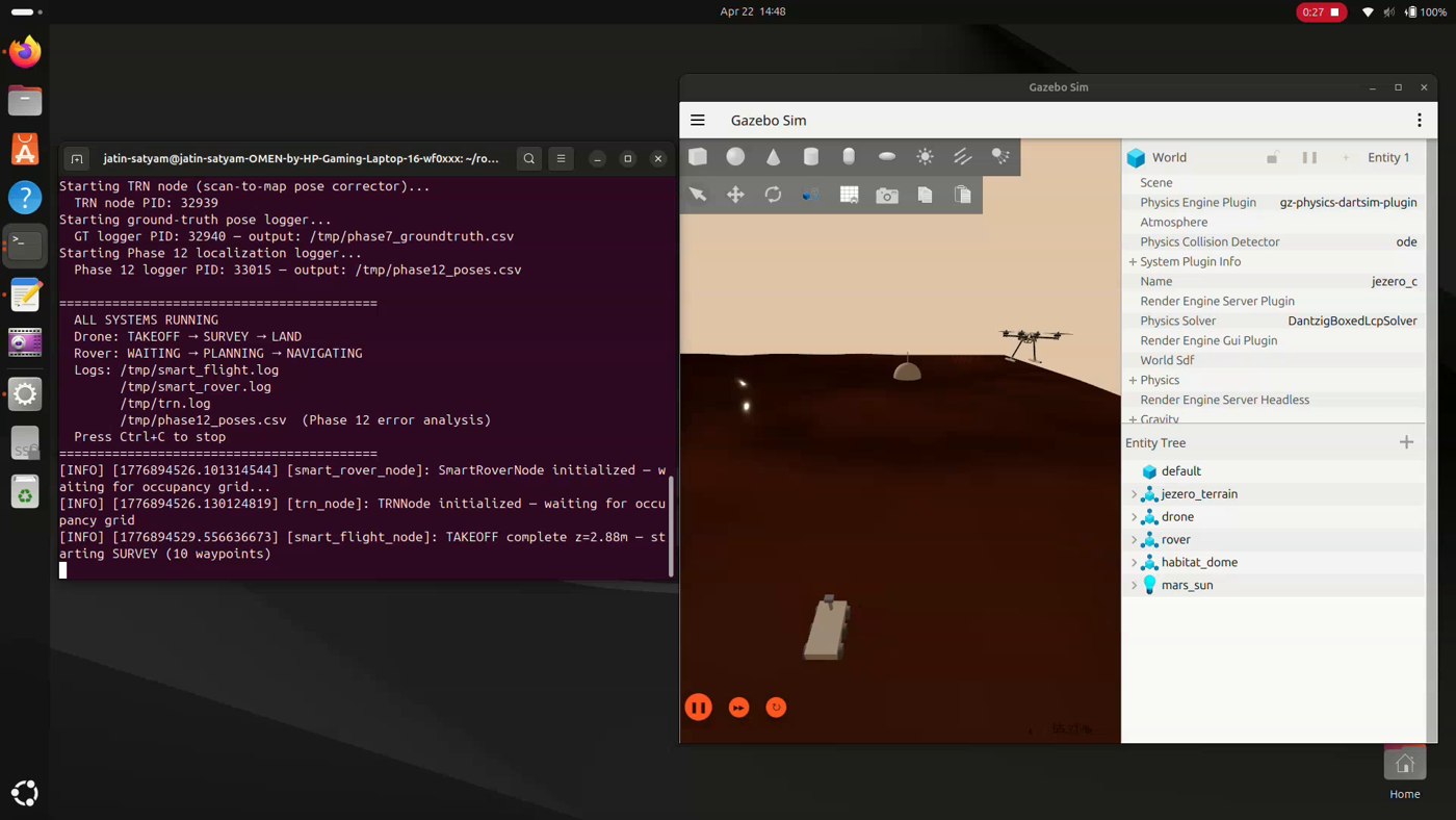
- The terrain is real: a 40 x 40 m patch of Jezero Crater from the USGS Mars 2020 mosaic, the same product used by Perseverance's landing software, centered 300 m from the rover's landing site. A custom GDAL to mesh pipeline turned the HiRISE digital terrain model (DTM) into simulation terrain when Gazebo's heightmaps proved unsupported.
- Two builds share the project: a survey to map to plan pipeline (drone imagery through COLMAP and 3D Gaussian Splatting into a traversability costmap), and a full cooperative mission with three self written ROS 2 nodes. Every number is physics simulated, none scripted.
Design & Build
- Survey: The drone maps the site into a Bayesian log odds occupancy grid, cutting false obstacle cells from hundreds to under ninety with zero false positives in the verified run.
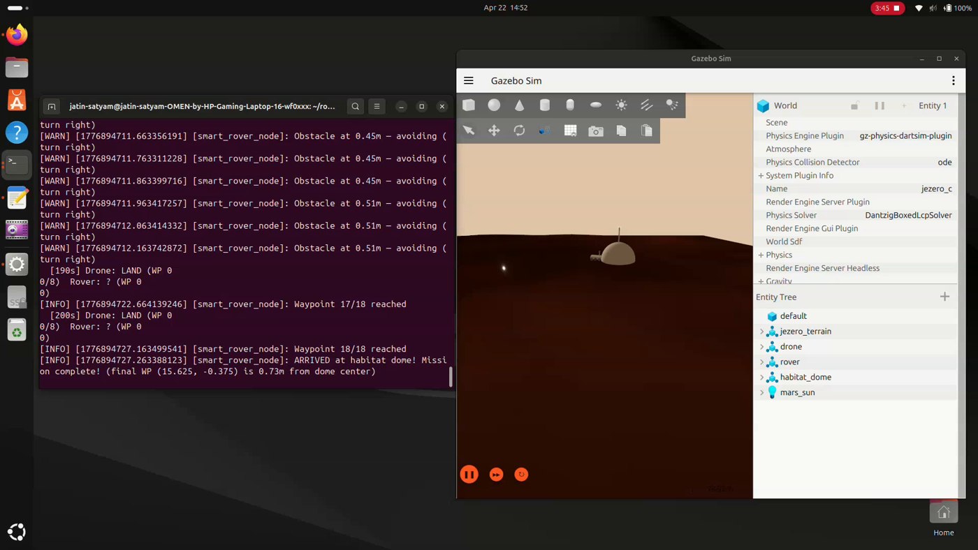
- Planning: A from scratch A* planner on the drone's map, costing unknown cells at triple rate, drives the rover through 18 waypoints to the habitat dome.
- Localization: A terrain relative navigation node matches LiDAR scans against the drone's map at 2 Hz across 294 candidate poses, blended with odometry behind covariance and magnitude guards.
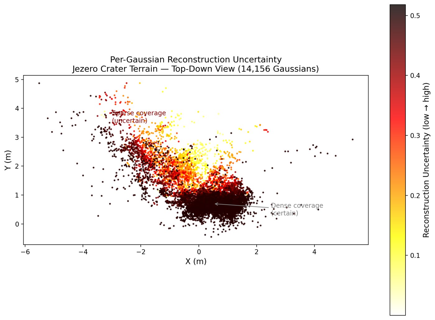
- Reconstruction: 2,000 survey frames through COLMAP and splatfacto produce a 14,156 Gaussian splat; an uncertainty aware ablation shows the planner correctly refusing goals outside surveyed coverage.
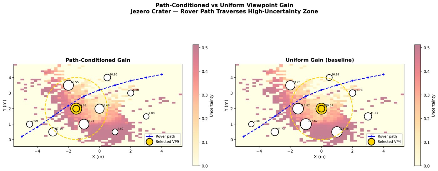
- Paper: An IEEE format paper proposes path conditioned next best view planning on the splat substrate, with a pilot experiment showing path conditioning changes which viewpoint wins.
Challenges
- A 90 percent wheel slip failure on the terrain mesh, diagnosed by comparing odometry against physical displacement and fixed with terrain friction and six wheel drive for a nine fold improvement.
- Honest result: terrain relative corrections beat odometry only in a mid terrain window, +15 to +24 percent, and underperformed overall on this sparse map. The report says so, and says why.
- Gazebo's physics engine rejected heightmaps entirely, forcing a custom terrain pipeline with per vertex normals to avoid solver crashes.
Result
- 18 of 18 waypoints reached, final position 0.73 m from the habitat dome center, full mission in about 145 seconds of simulation.
- A 7 page IEEE format paper with 29 references, publication grade figures, and a deliberately scoped pilot experiment.
Skills & Tools
ROS 2 JazzyGazebo HarmonicPythonA* PlanningBayesian Mapping3D Gaussian SplattingCOLMAPTerrain-Relative Navigation